Views through Britannia Colliery
Here are a some photos taken from the top of the tip looking down the valley.
This will be the route that the road will take to come into the park


posted by Angel Way @ 1:19 pm
0 comments
![]()
Bargoed Country Park from when the colliery was there through the colliery reclamation and onto the construction of the new By Pass namely "Angel Way" PLEASE ADD COMMENTS TO LET ME KNOW WHAT YOU THINK OF THE CONTENT ALSO DON'T FORGET TO REVISIT POSTINGS AS I UPDATE WITH EXTRA PHOTOS AS THEY COME IN. THANKS FOR VISITING
posted by Angel Way @ 1:19 pm
0 comments
![]()
 Can anyone tell me what the tower in the centre of the photo above was for ?

posted by Angel Way @ 1:03 pm
4 comments
![]()
posted by Angel Way @ 12:54 pm
0 comments
![]()

.jpg)


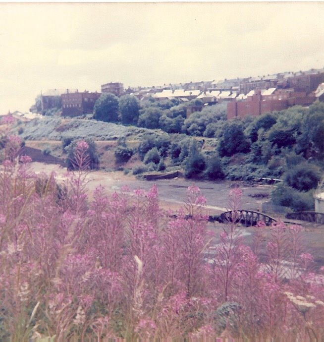
As I mentioned earlier in the blog the Rhymney River was in a terrible state when it was used to clean the coal from the colliery.
Nature is wonderful though, less than a decade later and you can see how clear the river is in the picture below
Here is a close up of the same photo and you can see to the bootom of the river.
.jpg)
posted by Angel Way @ 8:04 pm
0 comments
![]()


posted by Angel Way @ 7:32 pm
0 comments
![]()


posted by Angel Way @ 7:20 pm
0 comments
![]()

Autumn
It was a very windy day when this one was taken
you can see how the trees were bending in the wind

posted by Angel Way @ 7:11 pm
0 comments
![]()
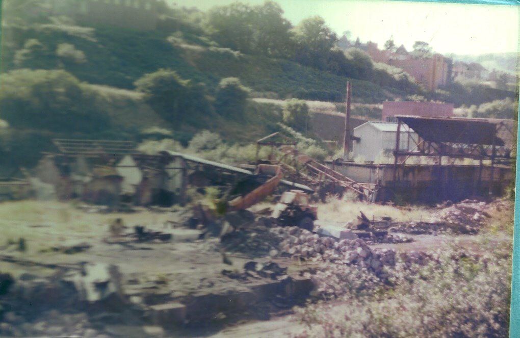
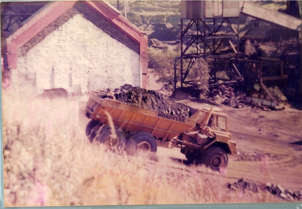
These photos are not so good but I had to show them just for you to see how close the machines were to the houses in Tredegar Terrace, Duffryn Street and West View Villas the noise and dust must have been horrendous

The three story houses on the right of this photo have since been demolished and the area grassed over


posted by Angel Way @ 7:04 pm
0 comments
![]()


posted by Angel Way @ 1:28 pm
1 comments
![]()
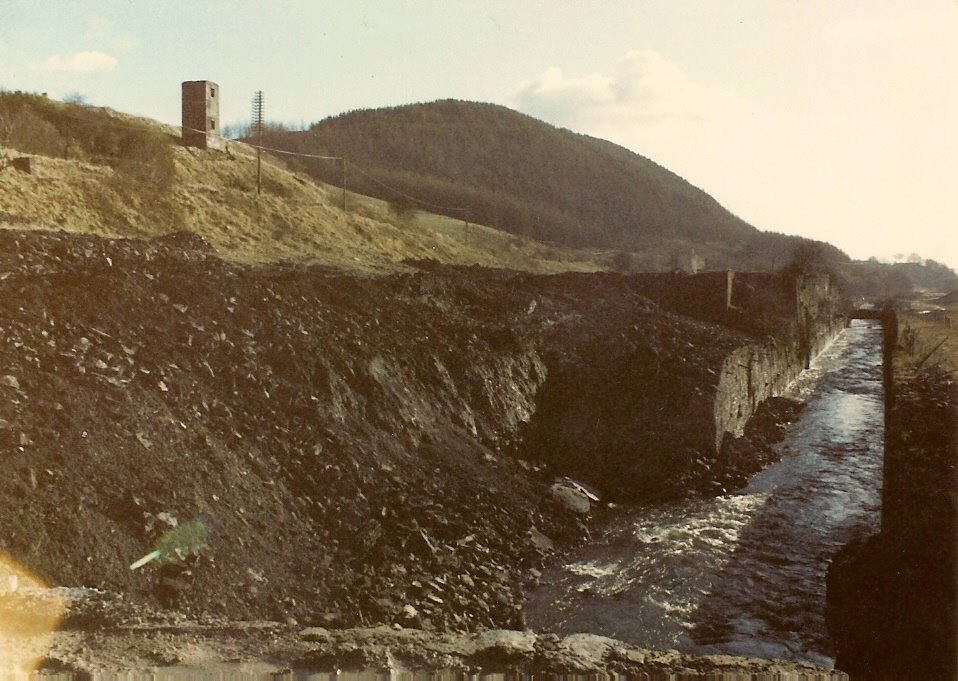 The photo alongside is of the river wall collapse
posted by Angel Way @ 5:05 pm
0 comments
![]()
Here is a very interesting photo it is of the concrete bridge that gave access from the top rail yard to the bottom yards one side of the colliery to the other across the Rhymney River. I am informed that it is one of the earliest concrete span bridges and was constructed by a German firm. I am still waiting for a date of construction and more information on this
The river was used to wash the coal that came up the shafts and was itself like black slurry after it was used.
When we were kids we were forbidden to go down to the river. Nothing lived in it only rats. As kids do we would go to play down the "Rhym" but was always found out by the black tide marks around our legs from wading in the river.
One story which I can not confirm mind you! Is that one enterprising fellow use to fish by tickling trout. On his way home from working nights at the colliery he thought he saw something move in the river so he got down on his stomach to tickle it out. When he made a grab for it and threw it onto the bank it was the biggest fattest rat he had ever seen
He never tried to fish in the Rhym again.
.jpg)
posted by Angel Way @ 1:59 pm
0 comments
![]()
Sorry about the lapse in updating the blog but my computer went on the blink and I had to restore it to the factory setting.
posted by Angel Way @ 1:24 pm
0 comments
![]()
